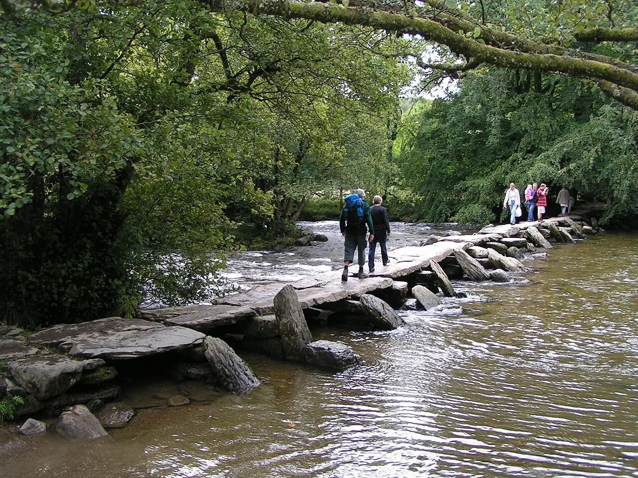

Tarr Steps and the River Barle
A prehistoric clapper bridge and a riverside loop through the Exmoor oakwoods.
- Distance
- 6.4 km
- Ascent
- 150 m
- Time
- 1.5–2.5 h
- Grade
- Easy
- Route
- Circular
- High point
- 293 m
Drag along the profile to see where you are on the map.
Offline navigation is coming in the TRXO app. Hear when it launches.
Route mapped on from OpenStreetMap paths, with heights from EU-DEM terrain data; not yet checked on the ground by TRXO. Added to TRXO on . For planning only: always navigate with an up-to-date map such as OS Explorer or Harvey. How we make our routes.
About this walk
Tarr Steps and the River Barle is an easy 6.4 km circular walk with 150 m of ascent, taking 1.5 to 2.5 hours. It starts at Tarr Steps car park (grid reference SS 870 325).
Tarr Steps is a bridge of seventeen giant stone slabs across the River Barle, perhaps Bronze Age, certainly medieval, and rebuilt after every big flood since. The walk crosses it and follows the river upstream through the oakwoods of the national nature reserve as far as Great Bradley bridge, then comes back the same way. Dippers and, if you're lucky, otters.
Route
-
1
The river
Cross Tarr Steps, follow the Barle upstream and return on the other bank.
Summit
Questions about this walk
- How long does Tarr Steps and the River Barle take?
- Most walkers take 1.5–2.5 hours for the 6.4 km route, which has 150 m of ascent. That allows for short stops; give yourself longer in winter, in poor weather or with a group.
- Where does the walk start, and where can I park?
- It starts at Tarr Steps car park (grid reference SS 870 325). Car park above the steps (charge).
- Can I get there by public transport?
- No practical public transport.
- How hard is it?
- It's graded easy. Riverside paths, muddy and rooty in places.
- Can I take my dog?
- Yes, dogs are welcome on this walk. Keep them on a lead near livestock.
Walked this? Tell the next walker
No reviews, condition reports, walkers' photos or trip reports for this walk yet. Yours would be the first.
Walks nearby


